Bachelor of Science in
Uncrewed Aircraft Systems
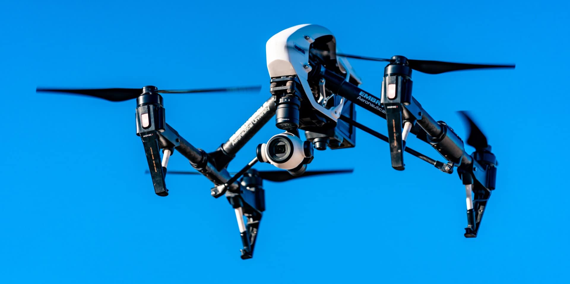
The FAA UAS-CTI recognized B.S. in Uncrewed Aircraft Systems prepares graduates to enter the UAS field with an understanding of business, regulatory and security issues.
About the Bachelor of Science in Uncrewed Aircraft Systems
Embry‑Riddle Aeronautical University is a leader in Uncrewed Aircraft Systems (UAS) curriculum, launching the first accredited program in the country. Students enrolled in the program explore coursework in aeronautical science, uncrewed aircraft systems, computer science, engineering, geographic information systems (GIS) and service learning.
Embry‑Riddle’s Bachelor of Science in Uncrewed Aircraft Systems equips students with the necessary knowledge and skills of UAS, emphasizing mission planning and execution, remote pilot operations, data collection and data processing.
Student Learning Outcomes
Learning opportunities you will have while studying in the drone program:
- Remote Sensing
- Geographic Information Systems (GIS)
- Aviation Safety
- UAS Maintenance
- Advanced Air Mobility (AAM)
Uncrewed Aircraft Systems Career Opportunities
Careers and Employers
Embry-Riddle graduates often find careers at Lockheed Martin, Amazon, Caci International and the U.S. Military, with a placement rate of 83.3% within a year of graduation.
Students earning a UAS degree often pursue careers as:
- Sensor Operator
- Operations Director
- Uncrewed Aerial Vehicle Systems Specialist
- Uncrewed Aircraft Systems Analyst
- Remote Pilot in Command (RPICs)
Uncrewed Aircraft Systems Salary Information
Embry-Riddle provides the opportunity for competitive salaries, with alumni averaging $81,200 annually one year post-graduation, as of 2022.
DETAILS
This offering is available at the following campuses. Select a campus to learn more.


About Uncrewed Aircraft Systems at the Daytona Beach, FL Campus
The Uncrewed Aircraft Systems degree at Embry‑Riddle’s Daytona Beach Campus is one of only a few in the nation. Housed in the Department of Aeronautical Science in the College of Aviation, the program provides students with access to the latest in automated technologies, state-of-the-art facilities and internationally recognized expert faculty.
Students in the program will be exposed to flight in actual environments, including Beyond-Visual Line of Sight (BVLOS) Operations using Remote Split Operations techniques. Flight experience, along with FAA and industry certifications gained throughout the curriculum, allow students to conduct flight operations as part of a two-part applied practicum.
Uncrewed Aircraft Systems Information
- Credits: 122
- Online or In-Person: In-Person
- Practicum: UAS Practicum I & UAS Practicum II
Professional Accreditation
The Uncrewed Aircraft Systems program is accredited by the Aviation Accreditation Board International (AABI). Detailed information on program education goals, student learning outcomes, and student achievement data can be found here.
Helpful Links
- Tour Our Daytona Beach Campus
- Discover the Department's Faculty
- Explore the Fields of Study: Space & Aviation
- Find Related Clubs & Organizations
Student Learning Outcomes
Students will:
- Apply knowledge of mathematics, science, and applied sciences at various levels of education.
- Analyze and interpret data provided from various sources.
- Make positive contributions and develop functional skills for multi-disciplinary and diverse team contributions.
- Understand the professional and ethical responsibility as it applies to the uncrewed aircraft industry and the broader aviation community.
- Develop effective technical writing and verbal communication skills.
- Recognize the need for, and demonstrate an ability to engage in, lifelong learning as it relates to their chosen profession.
- Apply knowledge of contemporary issues affecting the uncrewed aircraft system industry.
- Apply the techniques, skill, and modern technology necessary for safe professional practice in the uncrewed aircraft systems industry.
- Explain the national and international aviation environment with particular focus on uncrewed aircraft systems laws, regulations and labor issues.
- Apply pertinent knowledge in identifying and solving problems.
- Demonstrate knowledge of issues affecting and principles for promoting commercial viability and sustainability of the uncrewed aircraft system industry.
General Education Requirements
For a full description of Embry-Riddle General Education guidelines, please see the General Education section of this catalog. These minimum requirements are applicable to all degree programs.
| Communication Theory and Skills (COM 122 and COM 219 and COM 221) | 9 | |
| Lower-Level Humanities | 3 | |
| Lower-Level Social Science (PSY 101 required) | 3 | |
| Lower or Upper-Level Humanities or Social Sciences | 3 | |
| Upper-Level Humanities/Social Science | 3 | |
| Computer Science (CS 118 or CYB 235) | 3 | |
| Mathematics (MA 111 and MA 112) | 6 | |
| Physical Science (PS 113, PS 117, PS 113L or PS 117L) | 7 | |
| Total Credits | 37 | |
Aeronautical Knowledge
| AS 121 | Private Pilot Operations | 5 |
| AS 220 | Uncrewed Aircraft Systems | 3 |
| AS 309 | Aerodynamics | 3 |
| UA 100 | Remote Pilot Operations | 2 |
| Total Credits | 13 | |
Geospatial Data Acquisition and Processing
| AS 241 | UAS Systems Architecture and Integration | 3 |
| or AS 235 | Uncrewed Aircraft Systems Operation and Cross-Country Data Entry | |
| AS 368 | UAS Sensing Systems | 3 |
| AS 390 | Application of UAS Technology | 3 |
| GEO 210 | Introduction to Geographic Information Systems | 3 |
| GEO 310 | Advanced Geographic Information Systems | 3 |
| UA 201 | Mapping Applications and Data Collection with UAS | 1 |
| Total Credits | 16 | |
Operations and Leadership
| AS 222 | Uncrewed Aircraft Systems Security | 3 |
| AS 315 | UAS Robotics | 3 |
| AS 322 | Operational and Industrial Aspects of UAS | 3 |
| or AS 319 | UAS Law | |
| AS 323 | Crew Resource Management for UAS | 3 |
| AS 423 | UAS Infrastructure Development and Modeling | 3 |
| AS 473 | Operational Applications in Uncrewed Aircraft Systems | 3 |
| Total Credits | 18 | |
Technical Skills Development
| AS 416 | UAS Field Service and Sustainment | 3 |
| AS 437 | Concepts in Advanced Air Mobility | 3 |
| UA 301 | Advanced UAS Flight Operations | 1 |
| UA 401 | UAS Mission Application | 1 |
| Total Credits | 8 | |
Program Support
| EGR 120 | Graphical Communications | 3 |
| or EGR 115 | Introduction to Computing for Engineers | |
| AT 202 | Introduction to Air Traffic Management | 3 |
| HF 300 | Human Factors I: Principles and Fundamentals | 3 |
| Total Credits | 9 | |
Service Learning
| UA 390 | UAS Practicum I | 3 |
| UA 490 | UAS Practicum II | 3 |
| Total Credits | 6 | |
Open Electives
| Upper Level Open Electives - 300-400 | 6 | |
| Open Electives - Any Level | 9 | |
| Total Credits | 15 | |
| Total Credit Hours | 122 | |
Note: Refer to Undergraduate Academic Regulations and Procedures section for credit for flight training at other institutions.
After matriculation to Embry-Riddle, all flight training must be completed on-campus to earn the Uncrewed Aircraft Systems degree.
Suggested Plan of Study
Students should be aware that several courses in each academic year might have prerequisites and/or corequisites. Please check the course descriptions in this catalog before registering for classes to ensure requisite sequencing.
| Year One | ||
|---|---|---|
| Credits | ||
| UA 100 | Remote Pilot Operations | 2 |
| AS 121 | Private Pilot Operations | 5 |
| AS 220 | Uncrewed Aircraft Systems | 3 |
| COM 122 | English Composition | 3 |
| EGR 120 | Graphical Communications | 3 |
or EGR 115
|
Introduction to Computing for Engineers | |
| CS 118 | Fundamentals of Computer Programming | 3 |
or CYB 235
|
Computer and Network Technologies | |
| MA 111 | Pre-Calculus for Aviation | 3 |
| MA 112 | Applied Calculus for Aviation | 3 |
| HU 14X Humanities Elective | 3 | |
| COM 219 | Speech | 3 |
| Credits Subtotal | 31.0 | |
| Year Two | ||
| AS 222 | Uncrewed Aircraft Systems Security | 3 |
| AS 241 | UAS Systems Architecture and Integration | 3 |
or AS 235
|
Uncrewed Aircraft Systems Operation and Cross-Country Data Entry | |
| AS 323 | Crew Resource Management for UAS | 3 |
| AT 202 | Introduction to Air Traffic Management | 3 |
| COM 221 | Technical Report Writing | 3 |
| GEO 210 | Introduction to Geographic Information Systems | 3 |
| GEO 310 | Advanced Geographic Information Systems | 3 |
| PS 113 | Introductory Physics I | 3 |
| PS 117 | Introductory Physics II | 3 |
| PS 113L | Introductory Physics I Laboratory | 1 |
or PS 117L
|
Introductory Physics II Lab | |
| PSY 101 | Introduction to Psychology | 3 |
| Credits Subtotal | 31.0 | |
| Year Three | ||
| AS 309 | Aerodynamics | 3 |
| AS 315 | UAS Robotics | 3 |
| AS 322 | Operational and Industrial Aspects of UAS | 3 |
or AS 319
|
UAS Law | |
| AS 368 | UAS Sensing Systems | 3 |
| AS 390 | Application of UAS Technology | 3 |
| AS 416 | UAS Field Service and Sustainment | 3 |
| AS 437 | Concepts in Advanced Air Mobility | 3 |
| HF 300 | Human Factors I: Principles and Fundamentals | 3 |
| HU/SS Lower or Upper-Level Elective | 3 | |
| Open Elective - Upper-Level | 3 | |
| UA 201 | Mapping Applications and Data Collection with UAS | 1 |
| Credits Subtotal | 31.0 | |
| Year Four | ||
| AS 423 | UAS Infrastructure Development and Modeling | 3 |
| AS 473 | Operational Applications in Uncrewed Aircraft Systems | 3 |
| HU/SS Upper-Level Elective | 3 | |
| Open Elective - Upper-Level | 3 | |
| Open Elective | 9 | |
| UA 301 | Advanced UAS Flight Operations | 1 |
| UA 390 | UAS Practicum I | 3 |
| UA 401 | UAS Mission Application | 1 |
| UA 490 | UAS Practicum II | 3 |
| Credits Subtotal | 29.0 | |
| Credits Total: | 122.0 | |
Get Started Now:
Summary
122 Credits
Estimate your tuition by using the Tuition Calculator
View Financial Aid Information
Learn about our General Education
Find out about transferring credits to this degree
Learn more about our Veterans & Military benefits
View our Academic Calendar

Spotlight
About Uncrewed Aircraft Systems at the Prescott, AZ Campus
Focusing on commercial and civil applications, the Uncrewed Aircraft Systems (UAS) degree empowers graduates to meet current and future employment demands. Certified as a UAS-Collegiate Training Initiative Program, the UAS degree has evolved into one of the most hands-on degree programs offered at Embry‑Riddle and prepares graduates to enter a rapidly growing and changing industry.
UAS majors also gain a broad understanding of business, aviation regulations, technology, meteorology and security issues within the industry. All students in the Uncrewed Aircraft Systems degree program train at our on-campus airfield.
Tracks/Specialties and/or Certificates
Students pursuing an Uncrewed Aircraft Systems degree have the option to complete the following certificate:
- GIS and Remote Sensing Certificate: 12 credit hours
- FAA Remote Pilot In-Command (RPIC) Certificate
Uncrewed Aircraft Systems Information
- Credits: 120
- Online or In-Person: In-Person
- Capstone: UAS Capstone (AS475)
Helpful Links
- Tour Our Prescott Campus
- Discover the Department's Faculty
- Explore the Fields of Study: Space & Aviation
- Find Related Clubs & Organizations
Student Learning Outcomes
Students will:
- Use uncrewed aircraft systems properly by formulating and executing safe and efficient mission plans while being able to adapt to adverse and emergency situations.
- Compile imagery and other collected data from sensors used by several uncrewed aircraft systems and create products that effectively utilize the data obtained using on-board sensors.
- Show evidence of advanced concepts of uncrewed aircraft systems, aerospace, and aeronautics to solve problems commonly found in the small uncrewed aircraft systems industry.
- Demonstrate a basic understanding and compliance with national and international legislation and law pertaining to uncrewed aircraft.
- Show evidence of basic concepts in uncrewed aircraft systems safety and exercise safe practices.
- Show evidence of sound, ethical management principles within the uncrewed aircraft industry and formulate solutions to contemporary issues facing the uncrewed aircraft industry.
- Communicate effectively using clear and properly formatted technical writing, verbal communication, and visual displays.
Degree Requirements
The Bachelor of Science in Uncrewed Aircraft Systems may be attained in eight semesters. To earn the degree, successful completion of 120 credit hours is required.
Program Mission Statement
The Uncrewed Aircraft Systems (UNC) degree will provide the essential aeronautical, business, and legal knowledge and skills to obtain a successful career in the UAS industry. Graduates will be prepared for successful careers as Remote Pilots in Command (PICs), observers, payload operators, and/or operational managers of governmental and private sector UAS applications. Experience will be gained in aerial data collection, secure operations, long duration operations, highly detailed operations, and autonomous operations. Graduates will be prepared to meet current industry requirements with an emphasis on future industry developments such as Beyond Visual Line-of-Sight (BVLOS) operations and the use of multiple small UAS at the same time.
Program Requirements
General Education
Embry-Riddle degree programs require students to complete a minimum of 36 hours of General Education coursework. For a full description of Embry-Riddle General Education guidelines, please see the General Education section of this catalog.
Students may choose other classes outside of their requirements, but doing so can result in the student having to complete more than the degree's 120 credit hours. This will result in additional time and cost to the student.
| Communication Theory and Skills | 9 | |
| Computer Science/Information Technology | 3 | |
| Mathematics | 6 | |
| Physical and Life Sciences (Natural Sciences) | 6 | |
| Humanities and Social Sciences | 12 | |
3 hours of lower-level Humanities | ||
3 hours of lower-level Social Science | ||
3 hours of lower-level or upper-level Humanities or Social Science | ||
3 hours of upper-level Humanities or Social Science | ||
| Total Credits | 36 | |
Uncrewed Aircraft Systems Core (101 Credits)
The following course of study outlines the quickest and most cost-efficient route for students to earn their B.S. in Uncrewed Aircraft Systems. Students are encouraged to follow the course of study to ensure they complete all program required courses and their prerequisites within four years.
Courses in the core with a # will satisfy your general education requirements.
| AS 125 | Private and UAS Pilot Operations | 3 |
| AS 220 | Uncrewed Aircraft Systems | 3 |
| AS 235 | Uncrewed Aircraft Systems Operation and Cross-Country Data Entry | 3 |
| AS 309 | Aerodynamics | 3 |
| AS 310 | Aircraft Performance | 3 |
| AS 322 | Operational and Industrial Aspects of UAS | 3 |
| AS 323 | Crew Resource Management for UAS | 3 |
| AS 324 | Global Uncrewed Aircraft Systems (UAS) Regulations | 3 |
| AS 325 | Dronealism and Cinematography | 3 |
| AS 403 | Uncrewed Sensing Systems | 3 |
| AS 405 | Aviation Law | 3 |
| AS 473 | Operational Applications in Uncrewed Aircraft Systems | 3 |
| AS 475 | UAS Mission Execution ^ | 3 |
| AS 495W | Advanced UAS Videography | 3 |
| AT 200 | Air Traffic Basics I | 3 |
| BA 201 | Principles of Management | 3 |
| CI 310 | Intelligence, Surveillance and Reconnaissance | 3 |
| COM 122 | English Composition # | 3 |
| EC 200 | An Economic Survey (OR Lower-Level Social Science) # | 3 |
| or EC 210 | Microeconomics | |
| or EC 211 | Macroeconomics | |
| General Education - Communications Elective # | 6 | |
| General Education - Lower-Level Humanities # | 3 | |
| GEO 210 | Introduction to Geographic Information Systems | 3 |
| GEO 310 | Advanced Geographic Information Systems | 3 |
| IT 109 | Introduction to Computers and Applications # | 3 |
| SF 210 | Introduction to Aerospace Safety | 3 |
| MA 111 | Pre-Calculus for Aviation # | 3 |
| MA 112 | Applied Calculus for Aviation # | 3 |
| PS 113 | Introductory Physics I # | 3 |
| PSY 222 | Introduction to Industrial/Organizational Psychology (OR Lower-level or Upper-level Humanities or Social Science) # | 3 |
| PSY 326 | Occupational Health & Performance (OR Upper-level Humanities or Social Science) # | 3 |
| or PSY 345 | Training and Development | |
| UNIV 101 | College Success | 1 |
| WX 201 | Survey of Meteorology # | 3 |
| WX 203L | Survey of Meteorology Laboratory # | 1 |
| WX 301 | Aviation Weather | 3 |
Specified Electives (12 Credits)
Choose a total of 4 courses from the list of courses below:
| AT 305 | Introduction to Terminal Radar Operations | 3 |
| AT 401 | Advanced Terminal Radar Operations | 3 |
| BA 308 | Public Administration | 3 |
| BA 311 | Marketing | 3 |
| BA 328 | Professional Consulting | 3 |
| BA 337 | Entrepreneurship | 3 |
| BA 421 | Small Business Management | 3 |
| SF 320 | Human Factors in Aviation Safety | 3 |
| SIS 315 | Studies in Global Intelligence I | 3 |
| SIS 323 | Intelligence and Technology | 3 |
| SIS 420 | Aviation Security and Technology | 3 |
| SIS 422 | Homeland Security and Technology | 3 |
| SIS 430 | Emergency Management and Contingency Planning | 3 |
| WX 270 | Weather Information Systems | 3 |
| WX 364 | Weather for Aircrews | 3 |
| WX 365 | Satellite and Radar Weather Interpretation | 3 |
Open Electives (7)
| Open Electives | 7 | |
| Total Credits | 120 | |
- ^
The UAS Capstone (AS 475) is intended to be a culminating experience for the Bachelor of Science in Uncrewed Aircraft Systems degree and, therefore, will be the last course taken in the UAS core after completing AS 473 UAS Flight Simulation.
- #
General Education Course
All Army ROTC students are required to complete SS 321 - U.S. Military History 1900-Present (3 credits) in order to commission.
Suggested Plan of Study
| Freshman Year | ||
|---|---|---|
| Fall | Credits | |
| AS 125 | Private and UAS Pilot Operations | 3 |
| COM 122 | English Composition | 3 |
| IT 109 | Introduction to Computers and Applications | 3 |
| MA 111 | Pre-Calculus for Aviation | 3 |
| UNIV 101 | College Success | 1 |
| Credits Subtotal | 13.0 | |
| Spring | ||
| BA 201 | Principles of Management | 3 |
| Lower-Level Humanities | 3 | |
| MA 112 | Applied Calculus for Aviation | 3 |
| PS 113 | Introductory Physics I | 3 |
| WX 201 | Survey of Meteorology | 3 |
| WX 203L | Survey of Meteorology Laboratory | 1 |
| Credits Subtotal | 16.0 | |
| Sophomore Year | ||
| Fall | ||
| AS 220 | Uncrewed Aircraft Systems | 3 |
| AS 309 | Aerodynamics | 3 |
| Communication Theory and Skills Elective | 3 | |
| PSY 222 | Introduction to Industrial/Organizational Psychology (OR Lower-level or Upper-level Humanities or Social Science) | 3 |
| WX 301 | Aviation Weather | 3 |
| Credits Subtotal | 15.0 | |
| Spring | ||
| AS 235 | Uncrewed Aircraft Systems Operation and Cross-Country Data Entry | 3 |
| AS 310 | Aircraft Performance | 3 |
| Communication Theory and Skills Elective | 3 | |
| SF 210 | Introduction to Aerospace Safety | 3 |
| Specified Elective | 3 | |
| Credits Subtotal | 15.0 | |
| Junior Year | ||
| Fall | ||
| AS 322 | Operational and Industrial Aspects of UAS | 3 |
| AT 200 | Air Traffic Basics I | 3 |
| EC 200 | An Economic Survey (OR Lower-Level Social Science Elective) | 3 |
or EC 210
|
Microeconomics | |
or EC 211
|
Macroeconomics | |
| GEO 210 | Introduction to Geographic Information Systems | 3 |
| Open Elective | 3 | |
| Credits Subtotal | 15.0 | |
| Spring | ||
| AS 323 | Crew Resource Management for UAS | 3 |
| AS 325 | Dronealism and Cinematography | 3 |
| AS 403 | Uncrewed Sensing Systems | 3 |
| GEO 310 | Advanced Geographic Information Systems | 3 |
| Specified Elective | 3 | |
| Credits Subtotal | 15.0 | |
| Senior Year | ||
| Fall | ||
| AS 324 | Global Uncrewed Aircraft Systems (UAS) Regulations | 3 |
| AS 473 | Operational Applications in Uncrewed Aircraft Systems | 3 |
| AS 495W | Advanced UAS Videography | 3 |
| CI 310 | Intelligence, Surveillance and Reconnaissance | 3 |
| Specified Elective | 3 | |
| Credits Subtotal | 15.0 | |
| Spring | ||
| AS 405 | Aviation Law | 3 |
| AS 475 | UAS Mission Execution | 3 |
| Open Electives | 4 | |
| PSY 326 | Group and Team Behavior (OR Upper-Level Humanities or Social Science) | 3 |
or PSY 345
|
Training and Development | |
| Specified Elective | 3 | |
| Credits Subtotal | 16.0 | |
| Credits Total: | 120.0 | |
GIS and Remote Sensing Certificate
The GIS and remote sensing certificate prepares students for employment in GIS and remote sensing-related careers. Due to its versatile use in many industries, the GIS certificate is open to all disciplines that use geospatial data to manage workflows, processes, policies, and high-level decision-making.
Students in this certification program will learn the most common GIS and remote sensing workflows to generate, process and apply geospatial data via in-depth, hands-on experiences using state-of-the-art GIS software. Emphasis is placed on the practical aspects of working with a GIS using easy-to-understand, step-by-step tutorials and instructor demonstrations.
Students who successfully complete the GIS and remote sensing certificate will have the necessary skills to compete and work in the field of GIS and remote sensing in both the public and private sectors. Moreover, GIS and remote sensing skills earned through this certificate are useful in supporting capstone projects, master theses and can provide students with a robust foundation to engage in a research career.
Certification Requirements
To obtain the proposed GIS and Remote Sensing Certificate (a total of 12 credit hours), students will be required to take the following four 3-credit hour GEO courses:
| GEO 210 | Introduction to Geographic Information Systems | 3 |
| GEO 310 | Advanced Geographic Information Systems | 3 |
| GEO 350 | Introduction to Remote Sensing with GIS | 3 |
| GEO 450 | Lidar Processing with GIS | 3 |
The GEO courses in the GIS and Remote Sensing Certificate should be taken in the order outlined above, but it is not necessary, except for GEO 210 which is a course prerequisite for GEO 310, GEO 350 and GEO 495. The content of study in each GEO course participating in this certificate is described in each GEO course already offered.
Get Started Now:
Summary
120 Credits
Estimate your tuition by using the Tuition Calculator
View Financial Aid Information
Learn about our General Education
Find out about transferring credits to this degree
Learn more about our Veterans & Military benefits
View our Academic Calendar
Spotlight
RELATED DEGREES
You may be interested in the following degrees: